Jefferson County
Jefferson County is on the west side of Denver County. As of the 2010 census, the population was 534,543, making it the fourth-most populous county in Colorado. The county seat is Golden, and the most populous city is Lakewood. The county has a total area of 774 square miles.
Arvada
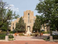
Arvada is a Home Rule Municipality in Jefferson and Adams counties, a part of the Denver-Aurora-Lakewood, CO Metropolitan Statistical Area in Colorado. As of the 2010 census the population was 106,433 and in 2019 the estimated population was 121,272, ranking Arvada as the seventh most populous municipality in Colorado. The Olde Town Arvada historic district is 7 miles northwest of the Colorado State Capitol in Denver. Arvada is located in northeastern Jefferson County; a small portion of the city extends east into Adams County. The city has a total area of 32.8 square miles.
Edgewater
Edgewater is a Home Rule Municipality located in Jefferson County, Colorado. Edgewater is located immediately west of Denver, in the Denver-Aurora-Lakewood, CO Metropolitan Statistical Area. As of the 2010 census, the population is 5,170. Edgewater is surrounded by Denver to the east, Lakewood to the south and west, and Wheat Ridge to the north. The city has a total area of 0.7 square miles.
Golden
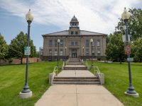
Golden is the Home Rule Municipality that is the county seat of Jefferson County, Colorado. Golden lies along Clear Creek at the base of the Front Range of the Rocky Mountains. Founded during the Pike’s Peak Gold Rush on June 16, 1859, the mining camp was originally named “Golden City” in honor of Thomas L. Golden. Golden City served as the capital of the provisional Territory of Jefferson from 1860 to 1861, and capital of the official Territory of Colorado from 1862 to 1867. In 1867, the territorial capital was moved about 12 miles east to Denver City. As of the 2010 census, the city population was 18,867. The City has a total area of 9.73 square miles.
Lakewood
Lakewood is a home-rule municipality that is the most-populous municipality in Jefferson County, Colorado. Lakewood is the fifth-most populous city in Colorado and the 172nd-most populous city in the United States. The city population was 142,980 at the 2010 United States Census. The City of Lakewood was incorporated in 1969 as Jefferson City. Soon after, an election was held and the city’s name was changed to Lakewood, due to an overwhelming dislike of “Jefferson City”. The city lies immediately west of Denver and has a total area of 44.06 square miles.
Littleton
Littleton is the Home Rule Municipality in Arapahoe, Douglas, and Jefferson counties that is the county seat of Arapahoe County, Colorado, United States. The city is a part of the Denver-Aurora-Lakewood, CO Metropolitan Statistical Area. The city population was 41,737 at the 2010 United States Census, ranking as the 20th most populous municipality in the State of Colorado. The city is 9 miles south of downtown Denver and the city has a total area of 13.87 square miles.
Westminster
Westminster is a Home Rule Municipality in Adams and Jefferson counties in the U.S. state of Colorado. Westminster is a northwest suburb of Denver. The Westminster Municipal Center is located 9 miles north-northwest of the Colorado State Capitol. As of the 2010 census the population of Westminster was 106,114, and as of 2019 the estimated population was 113,166. Westminster is the seventh most populous city in Colorado and the 237th most populous city in the United States. Westminster is a part of the Denver-Aurora-Lakewood, CO Metropolitan Statistical Area and the Denver-Aurora-Boulder Combined Statistical Area. Westminster is located in western Adams County and northeastern Jefferson County. The city has a total area of 34.05 square miles.
Wheat Ridge
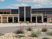
Wheat Ridge is a Home Rule Municipality located in Jefferson County, Colorado. Wheat Ridge is a western suburb of Denver. The Wheat Ridge Municipal Center is approximately 5 miles west-northwest of the Colorado State Capitol in Denver. The city had a population of 30,166 as of the 2010 Census. The city is immediately west of Denver and has a total area of 9.55 square miles.
Bow Mar
Bow Mar is a Statutory Town in Arapahoe and Jefferson counties in the U.S. state of Colorado. The town population was 866 at the 2010 United States Census. Bow Mar is a part of the Denver-Aurora-Lakewood, CO Metropolitan Statistical Area. The town has a total area of 0.8 square miles.
Lakeside
Lakeside is a Statutory Town in Jefferson County, Colorado. The town population was 8 at the 2010 United States Census, making Lakeside the least populous municipality in the State of Colorado. Lakeside is immediately west of the City and County of Denver, the most populous municipality in the state. The Denver Post Office (ZIP Code 80212) serves Lakeside. The town’s namesake lake is Lake Rhoda, which covers 20% of its total area. A year after its incorporation on November 12, 1907, the Lakeside Amusement Park, nicknamed “White City”, opened on the eastern shores. The town has a total area of 0.2 square miles.
Morrison
Morrison is a Home Rule Municipality in Jefferson County, Colorado, United States. The population was 428 at the 2010 census. Red Rocks Amphitheatre is located nearby. The town has a total area of 2.2 square miles. The Morrison postal ZIP code (80465) extends west up Turkey Creek Canyon and south of the town. It thus applies to an area covering approximately 5,000 addresses. Because the Morrison Post Office serves this large area beyond the town boundaries proper, many events and people connected with “Morrison” are actually in unincorporated portions of Jefferson County.
Mountain View
Mountain View is a home rule municipality located in Jefferson County, Colorado. Mountain View is situated west of, and adjacent to, the city and county of Denver. As of the 2010 census, the population of Mountain View was 507. The Denver Post Office (ZIP Code 80212) serves Mountain View. Mountain View has a total area of 0.09 square miles.
Superior
Superior is a Statutory Town in Boulder County in Colorado, with a small, uninhabited segment of land area extending into Jefferson County. According to the 2010 census, the population of the city was 12,483. The town has a total area of 4.01 square miles.
Evergreen
Evergreen is a census-designated place (CDP) and a U.S. Post Office in Jefferson County, Colorado. Evergreen is roughly 29 miles west of Denver. The population was 9,038 at the 2010 census. The CDP has a total area of 11.6 square miles.
Genesee
Genesee is a census-designated place (CDP) in Jefferson County, Colorado. The population was 3,609 at the 2010 census. Genesee is located about 26 miles from downtown Denver and the CDP has a total area of 6.7 square miles.
Indian Hills
Indian Hills is a census-designated place (CDP) in Jefferson County, Colorado. The population was 1,280 at the 2010 census. The Indian Hills Post Office has the ZIP Code 80454 and is in the extreme southwest corner of the metro area. The CDP has a total area of 4.7 square miles.


